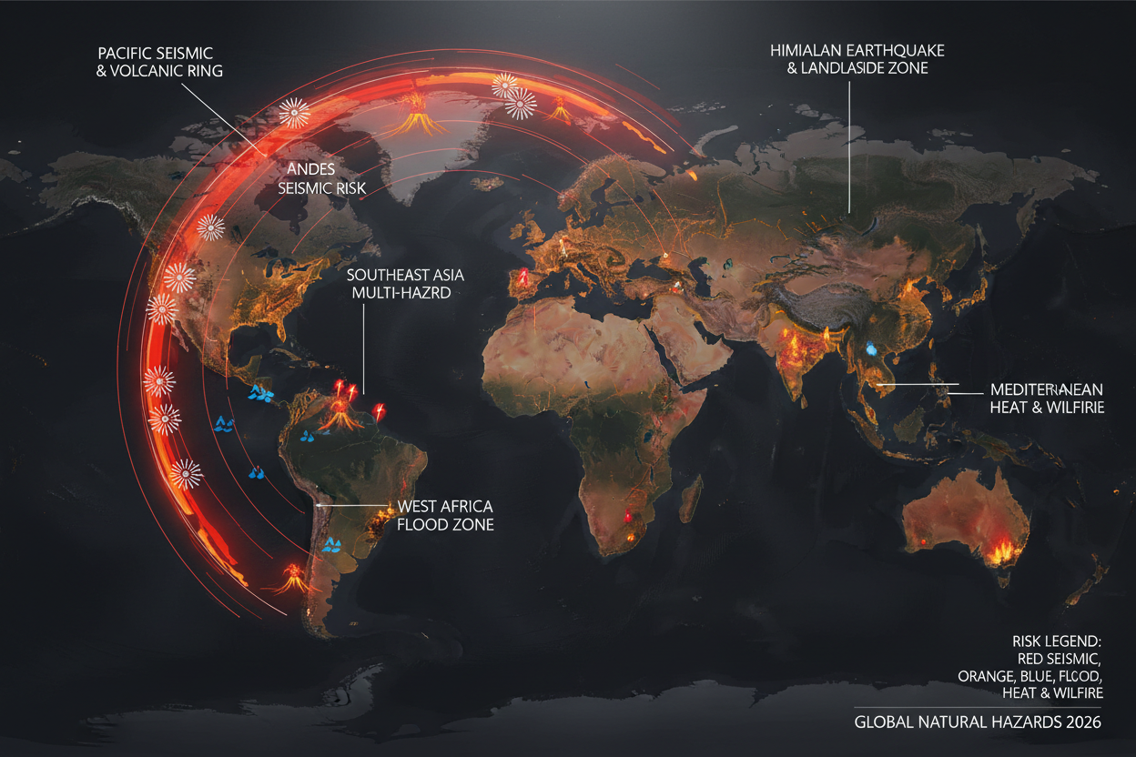


Article: Tectonic Plates, Global Seismicity & Volcanism in 2026: Origins, Processes and Surface Impacts
Tectonic Plates, Global Seismicity & Volcanism in 2026: Origins, Processes and Surface Impacts
TECTONIC PLATES, GLOBAL SEISMICITY & VOLCANISM IN 2026
Origins, Processes and Surface Impacts — A Comprehensive Scientific Review
📋 TABLE OF CONTENTS
- Earth as a Moving Planet
- How Did Earth's Plates Form?
- What Actually Drives Plate Motion?
- The Four Principal Plate-Boundary Types
- The Pacific Ring of Fire
- Major 2026 Earthquakes: Colombia, Venezuela, Indonesia & More
- Volcanism in 2026
- Stable Continental Interiors and Cratons
- Can Scientists Predict Earthquakes and Eruptions?
- A Traveler's Guide to Seismic and Volcanic Regions
- Frequently Asked Questions
- Sources & References
Earth is a tectonically active planet whose surface is continually reorganized by the movement of rigid lithospheric plates over the weaker asthenosphere beneath them. Plate tectonics operates on timescales vastly longer than human lifetimes, yet its consequences are expressed abruptly through earthquakes, volcanic eruptions, tsunamis, mountain building, rifting, faulting, landslides, and permanent changes to coastlines and landscapes.
The year 2026 illustrates the diversity of tectonic behavior particularly well. Major earthquakes struck Indonesia, Vanuatu, Japan, the Philippines, Venezuela and Colombia. Among the most significant was the 30 March magnitude 7.3 Vanuatu earthquake, the 1 April magnitude 7.4 Molucca Sea earthquake, the 24 June magnitude 7.2 and 7.5 Venezuela sequence, and the catastrophic 10 August magnitude 7.4 Colombia earthquake.

Earth's tectonic plate boundaries visualized — a planet in constant motion. The lithospheric plates move at rates of a few millimetres to several centimetres per year.
1. Earth as a Moving Planet
The outer solid Earth is not a single rigid shell. It consists of the lithosphere — a mechanically strong layer comprising the crust and uppermost mantle — broken into plates. These plates move relative to one another at rates ranging from only a few millimetres per year to roughly ten centimetres per year.
The underlying asthenosphere is hotter and mechanically weaker over geological timescales. It is not a global ocean of liquid rock: most of it is solid, but temperatures and pressures allow it to deform slowly. Plates do not simply "float" like icebergs on a molten mantle. Their movement is the result of coupled behaviour of dense lithosphere, mantle convection, gravity, plate-boundary forces, and the sinking of old oceanic slabs.
Continental crust is relatively thick and buoyant; oceanic crust is thinner and denser — typically 5–10 km thick, compared with several tens of kilometres for continental crust. This difference is fundamental to subduction: cold oceanic lithosphere becomes increasingly dense as it ages, eventually descending beneath another plate into the mantle. Continental lithosphere resists this sinking, so continental collision typically produces crustal shortening, folding and mountain building instead.
2. How Did Earth's Plates Form?
The origin of plate tectonics is one of the great unresolved questions in Earth science. The early Earth was far hotter than today, and the precise transition to a mobile-lid, plate-tectonic regime remains debated among geologists.
Evidence from ancient continental rocks shows that strong, buoyant continental lithosphere — called cratons — was established billions of years ago. Some cratonic mantle keels formed approximately 1.5–3.5 billion years ago and can reach hundreds of kilometres in thickness. Modern-style plate tectonics probably did not switch on at one identifiable instant; it developed progressively as the planet cooled.

The Pacific Ring of Fire — a vast network of subduction zones, transform faults and volcanic arcs surrounding the Pacific Ocean, home to approximately 57% of the world's Holocene volcanoes.
3. What Drives Plate Motion?
Several forces contribute to plate movement. Slab pull — the gravitational descent of cold, dense oceanic lithosphere at subduction zones — is widely considered the most important modern driver. Ridge push contributes a gravitational component as hot, elevated lithosphere at mid-ocean ridges pushes outward. Mantle coupling (basal drag from mantle flow) and gravitational potential energy from thickened mountain belts also play roles.
Plate velocity is measured with GPS and geodetic techniques on human timescales, while geological and palaeomagnetic observations reveal motion over millions of years. The modern view is not that one mechanism "turns the plates" — plate motion emerges from a coupled system in which slab pull, ridge forces, mantle flow and plate-boundary resistance interact.
4. The Four Principal Plate-Boundary Types
Divergent boundaries occur where plates move apart. At mid-ocean ridges, mantle material rises, undergoes decompression melting, and generates basaltic magma — new oceanic crust. When divergence occurs within a continent, it produces a rift valley (as in East Africa).

Subduction zone cross-section: cold oceanic lithosphere descends beneath the continental plate. Water released from the slab promotes melting in the mantle wedge above, feeding the volcanic arc.
Convergent boundaries and subduction are Earth's most powerful earthquake-generating environments. Where plates converge, one may descend beneath another. The interface can become locked, accumulating elastic strain until a megathrust earthquake ruptures it. Subduction also generates volcanic arcs as water-rich fluids from the descending slab promote melting in the mantle wedge above.
Continental collision occurs when two continents converge — neither easily subducted because continental crust is buoyant. The result is crustal shortening, fold-and-thrust belts, and enormous mountain ranges. The Himalaya are the archetype.
Transform boundaries occur where plates slide horizontally past one another. The San Andreas Fault is the best-known example. Where a strike-slip fault bends, local stress fields can produce compression (uplift) or extension (pull-apart basins).

The San Andreas Fault — the Pacific Plate moves northwest relative to North America at approximately 35 mm/yr. Some segments creep; others lock and accumulate decades of elastic strain before rupturing.
5. The Pacific Ring of Fire
The Pacific Ring of Fire is not a single geological structure but a broad network of subduction zones, transform faults, volcanic arcs and plate boundaries surrounding much of the Pacific Ocean. The Smithsonian Global Volcanism Program identifies approximately 688 Holocene volcanoes in 41 volcanic regions around the Ring of Fire — about 57% of the world's Holocene volcanoes.
Key segments include the Andes (Nazca Plate subducting beneath South America at ~65–80 mm/yr), Central America and Mexico (Cocos Plate beneath the Caribbean), Alaska and the Aleutians (Pacific Plate beneath North America), Japan (one of Earth's most complex plate junctions), the Philippines, Indonesia, and New Zealand.

The Himalayan mountain chain — product of India colliding with Eurasia at approximately 40–50 mm/yr. The crust has been shortened and thickened to produce the highest elevations on Earth.
6. Major 2026 Earthquakes
The following major seismic events were documented through 11 August 2026:
- 2 January — San Marcos, Mexico (M6.5): Cocos–North American convergent system; significant regional shaking in a highly active tectonic environment.
- 30 March — Vanuatu (M7.3): Intermediate-depth oblique-thrust earthquake at ~121 km depth within the subducting Australia Plate. Widely felt across the southwest Pacific.
- 1 April — Molucca Sea, Indonesia (M7.4): Reverse faulting in the extraordinarily complex Molucca Sea region involving the subducted Halmahera slab. Sunda and Philippine Sea plates converge at approximately 100 mm/yr.
- 24 June — Venezuela (M7.2 + M7.5): Two major shallow earthquakes west of Caracas at ~10 km depth. Significant landslide hazard confirmed by USGS ground-failure analysis.
- 10 August — Western Colombia (M7.4): The most significant global seismic event of 2026 through the 11 August cutoff. Intermediate-depth earthquake (~100–110 km) near San José del Palmar, Chocó. Widely felt in Quibdó, Pereira, Manizales, Cali, Armenia and Bogotá. Severe structural damage reported; casualty figures evolving during ongoing rescue operations.

A seismograph recording earthquake waves. Modern seismology can locate earthquakes, estimate magnitude rapidly, map shaking and operate early-warning systems — but cannot reliably predict the exact time of a future event.
Why was the Colombia earthquake so widely felt? Its intermediate depth (~100 km) distributed seismic energy over a vast area rather than concentrating devastation in one location. It occurred within the Nazca Plate subduction system beneath South America — the same system that drives Colombia's active volcanoes, including Puracé, which was already experiencing low-level eruptive activity and unrest in July 2026.
7. Volcanism in 2026
The Smithsonian Global Volcanism Program's database recorded 47 volcanoes with eruptions during 2026 in data available through its 31 March update. Annual totals are provisional and should not be interpreted as evidence of a sudden global increase — apparent increases in reported volcanism are substantially influenced by improvements in monitoring and satellite observation.

Mayon Volcano, Philippines — one of 2026's most active volcanoes. Continuing lava effusion, pyroclastic density currents, incandescent rockfalls and ash-and-gas plumes were documented throughout July. Daily rockfalls numbered in the hundreds during peak activity.
Key 2026 volcanic activity included:
- Mayon, Philippines — Continuing lava effusion, pyroclastic density currents, hundreds of daily rockfalls, sulfur-dioxide emissions reaching thousands of tonnes per day.
- Lewotobi Laki-Laki, Indonesia — Repeated ash plumes and explosions; Level 3 alert maintained with 5 km exclusion zone.
- Merapi, Ibu and Krakatau, Indonesia — Continuing activity documented in Smithsonian/USGS weekly reports.
- Aira/Sakurajima, Japan — Active throughout the monitoring period.
- Puracé, Colombia — Low-level activity including seismicity, thermal anomalies, SO₂ emissions, deformation and intermittent gas-and-ash emissions through July 2026.
- Whakaari/White Island, New Zealand — Eruption recorded 10–24 March.
- Kīlauea, Hawaii — Continuing eruption in the intraplate Hawaiian hotspot system.
- Etna, Italy — Active in the Mediterranean convergent system.

The East African Rift System — approximately 3,000 km of active continental rifting separating the Nubian and Somalian plates. Over millions of years, continued extension may produce a new ocean basin.
8. Stable Continental Interiors and Cratons
Not all regions of Earth experience frequent earthquakes or volcanism. Cratons — ancient, mechanically strong continental regions — are underlain by unusually thick, strong mantle roots that have survived for billions of years. Some cratonic keels are 150–250 km thick. Examples include portions of the Canadian Shield, Brazilian Shield, African cratonic interiors, the Australian interior and the Siberian craton.
However, low hazard does not mean zero hazard. Ancient faults can be reactivated, far-field stresses can propagate through continents, and human-induced seismicity can occur around reservoirs and fluid-injection operations. The correct scientific phrase is comparatively low seismic hazard — not "no earthquake hazard."

Iceland — the only place on Earth where a mid-ocean ridge rises above sea level. The North American and Eurasian plates separate through Iceland at approximately 2 cm/yr, producing volcanic fissures, geothermal systems and earthquake swarms.
9. Can Scientists Predict Earthquakes and Eruptions?
Earthquakes: Modern seismology can locate earthquakes, estimate magnitude rapidly, map shaking, identify aftershocks statistically, estimate long-term probabilities, and operate early-warning systems in some regions. But scientists generally cannot predict the exact date, time, location and magnitude of a future earthquake. USGS explicitly notes that earthquakes do not produce reliably known warning signs that allow precise prediction.
Volcanic eruptions: Forecasting is generally more successful because magma migration often produces detectable precursors — earthquake swarms, volcanic tremor, ground deformation, GPS changes, sulfur dioxide and carbon dioxide emissions, thermal anomalies, and changes in crater lakes. However, forecasts remain probabilistic. Some volcanoes accelerate rapidly; others show months of unrest without erupting. Travelers should always monitor official volcano alerts rather than social-media predictions.

Tsunami formation: large, shallow megathrust earthquakes vertically displace the seafloor, transferring energy into the overlying water column. A tsunami can arrive within minutes. Do not wait for a siren — move immediately to higher ground.
10. A Traveler's Guide to Seismic and Volcanic Regions
Traveling to tectonically active regions is not inherently unsafe. Millions of people live and travel safely in Japan, Indonesia, New Zealand, Iceland, Italy, Chile, Mexico, Colombia, Greece, Turkey and other seismic regions every year. The goal is informed travel, not fear.
Before booking: Check the current hazard situation from the relevant national geological or volcanic observatory. Use USGS, EMSC and the national geological survey for earthquakes; use the Smithsonian Global Volcanism Program and national volcano observatories for volcanic activity. Do not rely on travel blogs, TikTok or unofficial earthquake prediction websites.
During an earthquake — Drop, Cover and Hold On: Get under a sturdy table, protect your head and neck, hold on until shaking stops. Stay away from windows. Do not use elevators. If outdoors, move away from buildings and power lines.
If on a coast: Strong or prolonged shaking, sudden sea withdrawal, or an unusual roaring sound from the ocean are natural tsunami warnings. Do not wait for a siren — move immediately to higher ground. A tsunami sequence may contain multiple waves; the first wave is not necessarily the largest.
Near a volcano: Never enter a closed volcano zone. Lahars (volcanic mudflows) can travel rapidly through valleys long after the main eruption. Follow observatory and civil-protection instructions at all times.
11. Frequently Asked Questions
Are tectonic plates floating on liquid magma?
No. The asthenosphere is predominantly solid rock — hot and weak enough to deform slowly over geological time, but not a global ocean of magma.
How fast do tectonic plates move?
Typically a few millimetres to several centimetres per year. Some of the fastest relative motions approach approximately 100 mm/yr, as in parts of eastern Indonesia.
Which plate boundary produces the biggest earthquakes?
Subduction zones produce the largest known earthquakes because enormous fault surfaces can rupture simultaneously. However, large earthquakes can also occur on transform and intraplate faults.
Why do subduction zones produce volcanoes?
Water and other volatiles carried downward by the subducting plate alter the melting behaviour of the mantle wedge above, promoting magma generation that feeds volcanic arcs.
Why are the Himalaya so high?
India is colliding with Eurasia at ~40–50 mm/yr. Because continental crust resists subduction, the crust has been shortened and thickened, producing extraordinary elevations.
Is Colombia especially earthquake-prone?
Yes. Colombia lies within a complex region involving Nazca Plate subduction, South American and Caribbean interactions, and numerous active faults. The 10 August 2026 earthquake illustrates the potential for major seismic events.
Did the August 2026 Colombia earthquake cause Puracé volcano to erupt?
There is currently no established evidence that the earthquake caused Puracé's volcanic activity. Puracé was already experiencing low-level eruptive activity throughout July 2026.
Can scientists predict the next major earthquake?
Not precisely. Scientists can estimate probabilities and identify hazardous faults, but there is currently no reliable method for predicting the exact time, location and magnitude of a future earthquake.
Is it safe to travel to earthquake-prone countries?
Yes, provided travelers understand local hazards, follow official guidance and know their evacuation routes. Japan, New Zealand, Chile, Italy, Iceland and Indonesia all have sophisticated monitoring and emergency systems.
Is there any place on Earth with zero tectonic hazard?
No. Some regions have exceptionally low seismic and volcanic hazard, but "zero hazard" is not scientifically defensible.
12. Sources & References
- U.S. Geological Survey (USGS) — Plate Tectonics and This Dynamic Earth
- USGS Earthquake Hazards Program — 2026 event pages for Vanuatu, Indonesia, Venezuela, Colombia
- Smithsonian Global Volcanism Program — 2026 eruption database and weekly volcanic activity reports
- European-Mediterranean Seismological Centre (EMSC)
- Servicio Geológico Colombiano — 10 August 2026 earthquake catalog
- Nature Geoscience — Deep links between intraplate volcanism and plate tectonics
- Nature — Building cratonic keels in Precambrian plate tectonics
- Reuters — Colombia earthquake reporting, 10 August 2026
- The Guardian — Colombia earthquake live coverage, 10 August 2026
- Veðurstofa Íslands (Icelandic Meteorological Office) — Iceland geodetic data